Geolocate

Tebrau topographic map

Click on the map to display elevation.

About this map

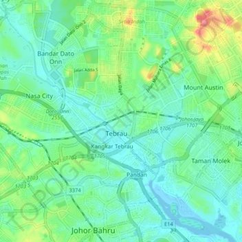
Name: Tebrau topographic map, elevation, terrain.

Location: Tebrau, Johor Bahru, Iskandar Malaysia, Johor, 81100, Malaysia (1.49959 103.71878 1.57959 103.79878)

Average elevation: 85 ft

Minimum elevation: -13 ft

Maximum elevation: 338 ft

Other topographic maps

Click on a map to view its topography, its elevation and its terrain.

Kampung Baru Pandan

Malaysia > Johor > Tebrau

Average elevation: 43 ft

Gear up for your next adventure:

👖Convertible Hiking Pants - Versatile zip-off pants for changing altitudes and temperatures
🪶Paracord Bracelet - Survival bracelet with built‑in tools
⛑️Personal Locator Beacon - Safety beacon for emergencies
🔪Outdoor Multitools - Essential survival tools for gear repair and field use
🧣Hiking Neck Gaiter - Multi‑use neck protection for outdoor weather

As an Amazon Associate, this site earns from qualifying purchases at no extra cost to you.