
Clinton topographic map
Click on the map to display elevation.
About this map
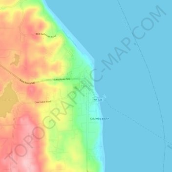
Name: Clinton topographic map, elevation, terrain.
Location: Clinton, Island County, Washington, 98236, United States (47.95795 -122.37601 47.99795 -122.33601)
Average elevation: 157 ft
Minimum elevation: -3 ft
Maximum elevation: 531 ft
Island County trails, hiking, mountain biking, running and outdoor activities
Other topographic maps
Click on a map to view its topography, its elevation and its terrain.
Ebey's Landing National Historical Reserve
United States > Washington > Island County
Average elevation: 82 ft