
Thank you for supporting this site ❤️
Make a donation
Make a donation
Gear up for your next adventure:
As an Amazon Associate, this site earns from qualifying purchases at no extra cost to you.
忠和村 topographic map
Click on the map to display elevation.
Thank you for supporting this site ❤️
Make a donation
Make a donation
Gear up for your next adventure:
As an Amazon Associate, this site earns from qualifying purchases at no extra cost to you.
About this map
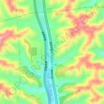
Name: 忠和村 topographic map, elevation, terrain.
Location: 忠和村, 盐场路街道, 城关区, 兰州市, 甘肃省, 中国 (36.17656 103.81948 36.18862 103.82346)
Average elevation: 5,781 ft
Minimum elevation: 5,489 ft
Maximum elevation: 6,148 ft
Thank you for supporting this site ❤️
Make a donation
Make a donation
Gear up for your next adventure:
As an Amazon Associate, this site earns from qualifying purchases at no extra cost to you.
Other topographic maps
Click on a map to view its topography, its elevation and its terrain.