
Thank you for supporting this site ❤️
Make a donation
Make a donation
Gear up for your next adventure:
As an Amazon Associate, this site earns from qualifying purchases at no extra cost to you.
gembong topographic map
Click on the map to display elevation.
Thank you for supporting this site ❤️
Make a donation
Make a donation
Gear up for your next adventure:
As an Amazon Associate, this site earns from qualifying purchases at no extra cost to you.
About this map
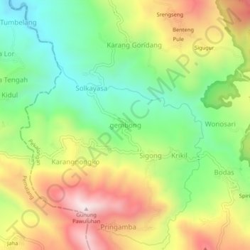
Name: gembong topographic map, elevation, terrain.
Location: gembong, Pekalongan, Central Java, Java, Indonesia (-7.22768 109.51659 -7.18768 109.55659)
Average elevation: 2,418 ft
Minimum elevation: 1,368 ft
Maximum elevation: 3,786 ft
Thank you for supporting this site ❤️
Make a donation
Make a donation
Gear up for your next adventure:
As an Amazon Associate, this site earns from qualifying purchases at no extra cost to you.