Geolocate

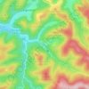
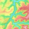
Hunting topographic map

Click on the map to display elevation.

About this map
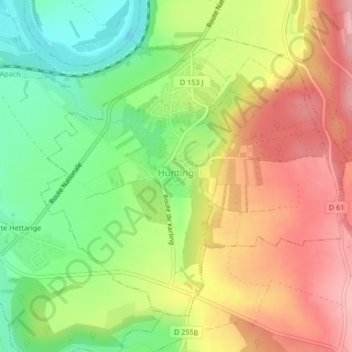
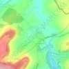
Name: Hunting topographic map, elevation, terrain.

Location: Hunting, Thionville, Moselle, Grand Est, Metropolitan France, 57480, France (49.40303 6.31017 49.42447 6.34641)

Average elevation: 679 ft

Minimum elevation: 449 ft

Maximum elevation: 906 ft

Other topographic maps

Click on a map to view its topography, its elevation and its terrain.
Everst Garten

France > Grand Est > Moselle > Villing > Trois Maisons

Average elevation: 938 ft

Saint-Pierremont

France > Grand Est > Moselle > Marsal

Average elevation: 745 ft

Grand Soldat

France > Grand Est > Moselle > Abreschviller

Average elevation: 1,391 ft

Metzing

France > Grand Est > Moselle > Riche

Average elevation: 774 ft

Falkenstein Castle

France > Grand Est > Moselle > Philippsbourg

In 1981, the Vosges Club (club vosgien) in Strasbourg placed a marker at the castle summit showing the altitude and directions to nearby land features.

Average elevation: 883 ft
Eschwiller Mill

France > Grand Est > Moselle > Eschviller

Average elevation: 988 ft

Fourneau Neuf

France > Grand Est > Moselle > Mouterhouse

Average elevation: 925 ft

Kapellenhof

France > Grand Est > Moselle > Hottviller

Average elevation: 1,056 ft

Holbach

France > Grand Est > Moselle

Average elevation: 1,086 ft

Mont Saint-Quentin

France > Grand Est > Moselle > Scy-Chazelles

Average elevation: 778 ft

Singling

France > Grand Est > Moselle

Average elevation: 1,070 ft

Crème

France > Grand Est > Moselle > Obreck

Average elevation: 748 ft

Hautes Phrases

France > Grand Est > Moselle > Château-Salins

Average elevation: 797 ft

Mont Saint-Quentin

France > Grand Est > Moselle > Scy-Chazelles

Average elevation: 778 ft

Moor

France > Grand Est > Moselle > Loudrefing

Average elevation: 791 ft

Audviller

France > Grand Est > Moselle > Wentzviller

Average elevation: 748 ft

Gear up for your next adventure:

📚USA Hiking Guide Books - Top trail guides and map books
📚Navigation Handbooks - Master the art of reading topographic maps and using a compass
🥇GPS Hiking Watch - Multi‑sport GPS watch with navigation and trail tracking
🧢Sun Protection Hats - Wide-brimmed and UPF-rated hats for high-altitude sun safety
🚑Emergency Bivvies - Heat-reflective sleeping bags for survival situations

As an Amazon Associate, this site earns from qualifying purchases at no extra cost to you.