Geolocate

Diya topographic map

Interactive map

Click on the map to display elevation.

About this map

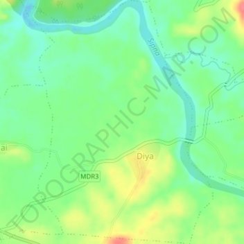
Name: Diya topographic map, elevation, terrain.

Location: Diya, Dharni, Amravati, Maharashtra, 444702, India (21.55125 76.91279 21.58143 76.93747)

Average elevation: 1,060 ft

Minimum elevation: 978 ft

Maximum elevation: 1,194 ft

Other topographic maps

Click on a map to view its topography, its elevation and its terrain.

Dudhani

India > Maharashtra > Dharni

Dudhani, Dharni, Amravati, Maharashtra, India

Average elevation: 1,263 ft

Patiya

India > Maharashtra > Dharni

Patiya, Dharni, Amravati, Maharashtra, India

Average elevation: 1,237 ft