
Thank you for supporting this site ❤️
Make a donation
Make a donation
Gear up for your next adventure:
As an Amazon Associate, this site earns from qualifying purchases at no extra cost to you.
Dudhani topographic map
Click on the map to display elevation.
Thank you for supporting this site ❤️
Make a donation
Make a donation
Gear up for your next adventure:
As an Amazon Associate, this site earns from qualifying purchases at no extra cost to you.
About this map
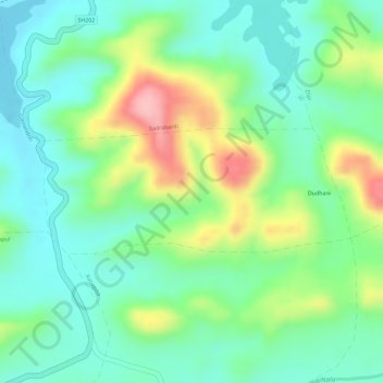
Name: Dudhani topographic map, elevation, terrain.
Location: Dudhani, Dharni, Amravati, Maharashtra, India (21.42760 76.78737 21.43645 76.81113)
Average elevation: 1,263 ft
Minimum elevation: 1,089 ft
Maximum elevation: 1,591 ft
Thank you for supporting this site ❤️
Make a donation
Make a donation
Gear up for your next adventure:
As an Amazon Associate, this site earns from qualifying purchases at no extra cost to you.