Geolocate

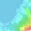
Baroña topographic map

Click on the map to display elevation.

About this map

Name: Baroña topographic map, elevation, terrain.

Location: Baroña, Porto do Son, Noia, La Coruña, Galicia, España (42.67626 -9.03383 42.71743 -8.95725)

Average elevation: 522 ft

Minimum elevation: -3 ft

Maximum elevation: 1,841 ft

Other topographic maps

Click on a map to view its topography, its elevation and its terrain.
O Castro

España > Galicia > Noia > Porto do Son

Average elevation: 262 ft

Cans

España > Galicia > Noia > Porto do Son

Average elevation: 230 ft

Alboreda

España > Galicia > Noia > Porto do Son

Average elevation: 184 ft

Xío

España > Galicia > Noia > Porto do Son

Average elevation: 223 ft

Gear up for your next adventure:

🥇GPS Hiking Watch - Multi‑sport GPS watch with navigation and trail tracking
🗺️NatGeo Topo Maps - High-quality waterproof printed topographic maps of US Parks
📡Handheld GPS Device - Reliable handheld GPS for outdoor navigation
🪓Survival Multi‑Tool - Versatile tool for camp and trail tasks
🎒Trail Energy Bars - High‑calorie bars for hiking energy

As an Amazon Associate, this site earns from qualifying purchases at no extra cost to you.