Geolocate

Powell topographic map

Click on the map to display elevation.

About this map

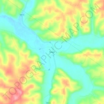
Name: Powell topographic map, elevation, terrain.

Location: Powell, McDonald County, Missouri, 65730, United States (36.60285 -94.20076 36.64285 -94.16076)

Average elevation: 1,119 ft

Minimum elevation: 961 ft

Maximum elevation: 1,339 ft

McDonald County trails, hiking, mountain biking, running and outdoor activities

Other topographic maps

Click on a map to view its topography, its elevation and its terrain.

Pineville

United States > Missouri > McDonald County

Average elevation: 1,030 ft

Southwest City

United States > Missouri > McDonald County

Average elevation: 988 ft

Noel

United States > Missouri > McDonald County

Average elevation: 942 ft

Goodman

United States > Missouri > McDonald County

Average elevation: 1,220 ft

Gear up for your next adventure:

🛏️Cold Weather Sleeping Bag - Warm sleeping bag for cold conditions
🦟Ultrasonic Repellers - Create a bug-free zone at your camp or rest stop
GPS Sports Watch - GPS watch for running, hiking and training
🪶LED Camping Lantern - Bright lantern for camp lighting
🩳Quick‑Dry Hiking Shorts - Comfortable and quick‑dry shorts for summer hiking

As an Amazon Associate, this site earns from qualifying purchases at no extra cost to you.