
Thank you for supporting this site ❤️
Make a donation
Make a donation
Gear up for your next adventure:
As an Amazon Associate, this site earns from qualifying purchases at no extra cost to you.
Selcho topographic map
Click on the map to display elevation.
Thank you for supporting this site ❤️
Make a donation
Make a donation
Gear up for your next adventure:
As an Amazon Associate, this site earns from qualifying purchases at no extra cost to you.
About this map
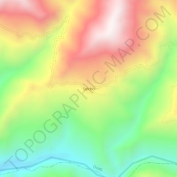
Name: Selcho topographic map, elevation, terrain.
Location: Selcho, Ocalli, Luya, Amazonas, Perú (-6.26585 -78.25905 -6.22585 -78.21905)
Average elevation: 4,918 ft
Minimum elevation: 3,340 ft
Maximum elevation: 6,722 ft
Thank you for supporting this site ❤️
Make a donation
Make a donation
Gear up for your next adventure:
As an Amazon Associate, this site earns from qualifying purchases at no extra cost to you.