Geolocate

Sušak topographic map

Click on the map to display elevation.

About this map

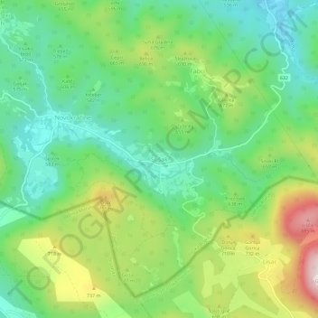
Name: Sušak topographic map, elevation, terrain.

Location: Sušak, Ilirska Bistrica, Slovenia (45.46779 14.30709 45.50779 14.34709)

Average elevation: 1,991 ft

Minimum elevation: 1,453 ft

Maximum elevation: 3,002 ft

Gear up for your next adventure:

📌Outdoor GPS Map App - Apps and devices for digital topographic navigation
📱Heavy-Duty Phone Cases - Drop-proof and waterproof protection for outdoor navigation
🩹Survival Bandages - High‑quality bandages for emergencies
🧭Compass with Lanyard - Easy‑carry compass for navigation
🚪Portable Camp Chair - Foldable chair for comfort at camp

As an Amazon Associate, this site earns from qualifying purchases at no extra cost to you.