
Thank you for supporting this site ❤️
Make a donation
Make a donation
Gear up for your next adventure:
As an Amazon Associate, this site earns from qualifying purchases at no extra cost to you.
Cordovado topographic map
Click on the map to display elevation.
Thank you for supporting this site ❤️
Make a donation
Make a donation
Gear up for your next adventure:
As an Amazon Associate, this site earns from qualifying purchases at no extra cost to you.
About this map
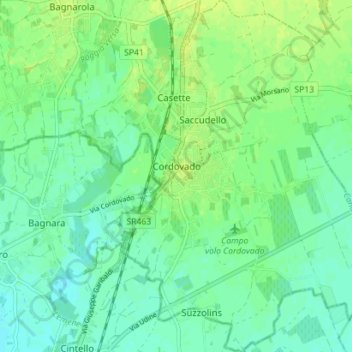
Name: Cordovado topographic map, elevation, terrain.
Location: Cordovado, Pordenone, Friuli – Venezia Giulia, 33075, Italy (45.81979 12.86967 45.86891 12.92138)
Average elevation: 46 ft
Minimum elevation: 20 ft
Maximum elevation: 75 ft
Thank you for supporting this site ❤️
Make a donation
Make a donation
Gear up for your next adventure:
As an Amazon Associate, this site earns from qualifying purchases at no extra cost to you.