Geolocate

Angoon topographic map

Click on the map to display elevation.

About this map

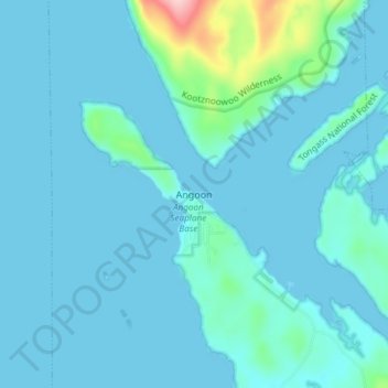
Name: Angoon topographic map, elevation, terrain.

Location: Angoon, Unorganized Borough, Alaska, 99820, United States (57.48333 -134.60389 57.52333 -134.56389)

Average elevation: 62 ft

Minimum elevation: -36 ft

Maximum elevation: 646 ft

Unorganized Borough trails, hiking, mountain biking, running and outdoor activities

Gear up for your next adventure:

🔌Solar Panel Charger - Charge gear sustainably outdoors
Backpacking Tent - Lightweight and durable tent for multi‑day hikes
🧴Hand Sanitizer - Keep hands clean while hiking
📖Nature Tracking Books - Learn to track wildlife and terrain
🚪Portable Camp Chair - Foldable chair for comfort at camp

As an Amazon Associate, this site earns from qualifying purchases at no extra cost to you.