
Thank you for supporting this site ❤️
Make a donation
Make a donation
Gear up for your next adventure:
As an Amazon Associate, this site earns from qualifying purchases at no extra cost to you.
Hira topographic map
Click on the map to display elevation.
Thank you for supporting this site ❤️
Make a donation
Make a donation
Gear up for your next adventure:
As an Amazon Associate, this site earns from qualifying purchases at no extra cost to you.
About this map
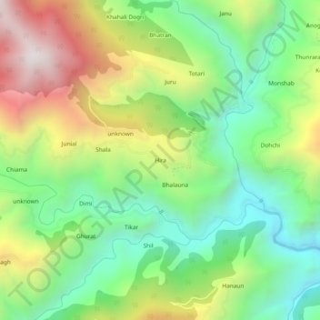
Name: Hira topographic map, elevation, terrain.
Location: Hira, Cheta, Shimla District, Himachal Pradesh, 171217, India (30.81063 77.56264 30.85063 77.60264)
Average elevation: 5,787 ft
Minimum elevation: 4,196 ft
Maximum elevation: 8,274 ft
Thank you for supporting this site ❤️
Make a donation
Make a donation
Gear up for your next adventure:
As an Amazon Associate, this site earns from qualifying purchases at no extra cost to you.