Geolocate

Wishllac topographic map

Click on the map to display elevation.

About this map

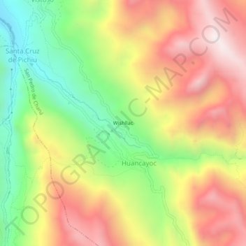
Name: Wishllac topographic map, elevation, terrain.

Location: Wishllac, Huancayoc, San Pedro de Chaná, Huari, Áncash, Perú (-9.52022 -77.01910 -9.48022 -76.97910)

Average elevation: 13,094 ft

Minimum elevation: 11,371 ft

Maximum elevation: 14,787 ft

Gear up for your next adventure:

🧥Men's Rain Shells - Premium waterproof and breathable jackets for mountain weather
🛏️Cold Weather Sleeping Bag - Warm sleeping bag for cold conditions
🌐World Map Poster - Decorative world maps with topographic info
🪶Paracord Bracelet - Survival bracelet with built‑in tools
📶Vehicle Signal Boosters - Improve reception in rural areas while driving to trailheads

As an Amazon Associate, this site earns from qualifying purchases at no extra cost to you.