Geolocate

T3 R10 WELS topographic map

Click on the map to display elevation.

About this map

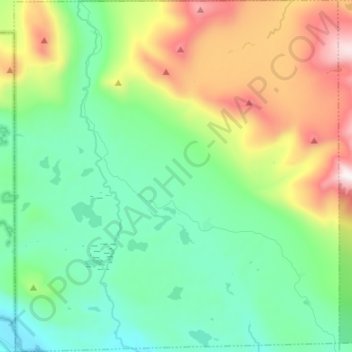
Name: T3 R10 WELS topographic map, elevation, terrain.

Location: T3 R10 WELS, Piscataquis County, Maine, United States (45.85342 -69.07261 45.94651 -68.94882)

Average elevation: 1,795 ft

Minimum elevation: 591 ft

Maximum elevation: 4,544 ft

Piscataquis County trails, hiking, mountain biking, running and outdoor activities

Other topographic maps

Click on a map to view its topography, its elevation and its terrain.

Schoodic

United States > Maine > Piscataquis County

Average elevation: 525 ft

Shirley Mills

United States > Maine > Piscataquis County > Shirley

Average elevation: 1,158 ft

Kokadjo

United States > Maine > Piscataquis County

Average elevation: 1,322 ft

Ebeemee Mountain

United States > Maine > Piscataquis County

Average elevation: 1,220 ft

Gear up for your next adventure:

🌡️Handheld Weather Meters - Measure wind, temp, and pressure for safe mountain travel
👖Convertible Hiking Pants - Versatile zip-off pants for changing altitudes and temperatures
🎒Day Hiking Backpack - Lightweight backpack perfect for day trips and outdoor adventures
🥇GPS Hiking Watch - Multi‑sport GPS watch with navigation and trail tracking
🧭Hiking Compass - Precision compass for reliable navigation in the wilderness

As an Amazon Associate, this site earns from qualifying purchases at no extra cost to you.