Geolocate

Mollebamba topographic map

Click on the map to display elevation.

About this map

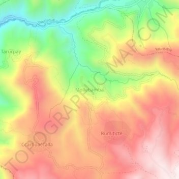
Name: Mollebamba topographic map, elevation, terrain.

Location: Mollebamba, Paccaritambo, Paruro, Cusco, Perú (-13.72797 -71.97986 -13.68797 -71.93986)

Average elevation: 11,280 ft

Minimum elevation: 9,783 ft

Maximum elevation: 12,493 ft

Gear up for your next adventure:

🎒Hydration Pack - Hands‑free water reservoir for long hikes
🧼Biodegradable Camping Soap - Eco‑friendly soap for outdoor hygiene
🥤Water Filter Bottle - All‑in‑one filter bottle for safe hydration
🧭Pro Hiking Compasses - High-accuracy liquid-filled compasses for topographic orientation
🪶Trail Camera - Capture wildlife on your hikes

As an Amazon Associate, this site earns from qualifying purchases at no extra cost to you.