
Groesbeck topographic map
Click on the map to display elevation.
About this map
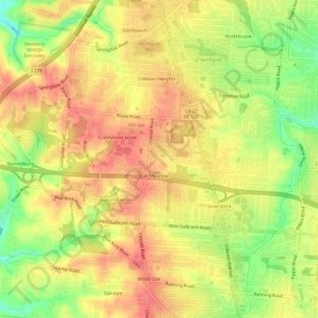
Name: Groesbeck topographic map, elevation, terrain.
Average elevation: 856 ft
Minimum elevation: 728 ft
Maximum elevation: 932 ft
Hamilton County trails, hiking, mountain biking, running and outdoor activities
Other topographic maps
Click on a map to view its topography, its elevation and its terrain.
South Clippinger
United States > Ohio > Hamilton County > The Village of Indian Hill
Average elevation: 827 ft
Cincinnati
United States > Ohio > Hamilton County
Cincinnati has several standard modes of transportation including sidewalks, roads, public transit, bicycle paths and airports. The city's hills preclude the regular street grid common to many cities built up in the 19th century, and outside of the downtown basin, regular street grids are rare except for in…
Average elevation: 738 ft
Norwood Heights
United States > Ohio > Hamilton County > Cincinnati > Norwood Heights
Average elevation: 679 ft