
Thank you for supporting this site ❤️
Make a donation
Make a donation
Gear up for your next adventure:
As an Amazon Associate, this site earns from qualifying purchases at no extra cost to you.
Juqui topographic map
Click on the map to display elevation.
Thank you for supporting this site ❤️
Make a donation
Make a donation
Gear up for your next adventure:
As an Amazon Associate, this site earns from qualifying purchases at no extra cost to you.
About this map
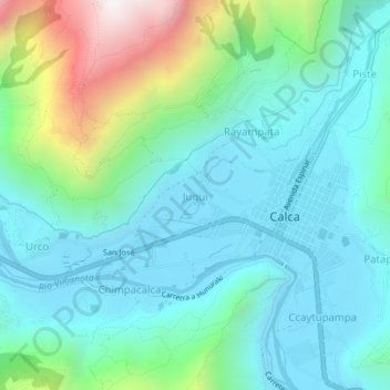
Name: Juqui topographic map, elevation, terrain.
Location: Juqui, Calca, Cusco, 08120, Peru (-13.33959 -71.98545 -13.29959 -71.94545)
Average elevation: 10,502 ft
Minimum elevation: 9,547 ft
Maximum elevation: 13,786 ft
Thank you for supporting this site ❤️
Make a donation
Make a donation
Gear up for your next adventure:
As an Amazon Associate, this site earns from qualifying purchases at no extra cost to you.