
Make a donation
Gear up for your next adventure:
As an Amazon Associate, this site earns from qualifying purchases at no extra cost to you.
Marmaduke topographic map
Click on the map to display elevation.
Make a donation
Gear up for your next adventure:
As an Amazon Associate, this site earns from qualifying purchases at no extra cost to you.
About this map
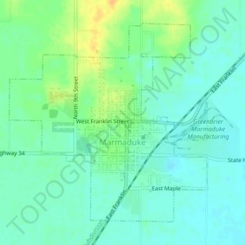
Name: Marmaduke topographic map, elevation, terrain.
Location: Marmaduke, Greene County, Arkansas, 72443, United States (36.17952 -90.40097 36.20140 -90.37390)
Average elevation: 285 ft
Minimum elevation: 253 ft
Maximum elevation: 348 ft
Greene County trails, hiking, mountain biking, running and outdoor activities
Make a donation
Gear up for your next adventure:
As an Amazon Associate, this site earns from qualifying purchases at no extra cost to you.
Other topographic maps
Click on a map to view its topography, its elevation and its terrain.
Crowleys Ridge State Park
United States > Arkansas > Greene County > Walcott
Average elevation: 354 ft