
Troy topographic map
Click on the map to display elevation.
About this map
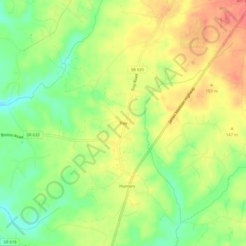
Name: Troy topographic map, elevation, terrain.
Location: Troy, Fluvanna County, Virginia, 22974, United States (37.93097 -78.26639 37.97097 -78.22639)
Average elevation: 443 ft
Minimum elevation: 328 ft
Maximum elevation: 554 ft
Fluvanna County trails, hiking, mountain biking, running and outdoor activities
Other topographic maps
Click on a map to view its topography, its elevation and its terrain.
Lake Monticello
United States > Virginia > Fluvanna County > Lake Monticello
Average elevation: 374 ft
Lake Monticello
United States > Virginia > Fluvanna County > Lake Monticello
Average elevation: 374 ft
Lake Monticello
United States > Virginia > Fluvanna County > Lake Monticello
Average elevation: 374 ft