
San Tammaro topographic map
Interactive map
Click on the map to display elevation.
About this map
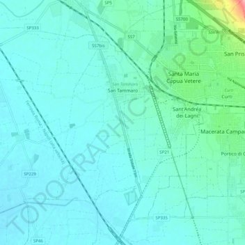
Name: San Tammaro topographic map, elevation, terrain.
Location: San Tammaro, Caserta, Campania, Italy (41.03647 14.14096 41.09551 14.24047)
Average elevation: 82 ft
Minimum elevation: 33 ft
Maximum elevation: 387 ft
Other topographic maps
Click on a map to view its topography, its elevation and its terrain.
Marcianise
Marcianise, Caserta, Campania, 81025, Italy
Average elevation: 95 ft
Camigliano
Camigliano, Caserta, Campania, 81040, Italy
Average elevation: 607 ft
Mondragone
Italy > Campania > Caserta > Mondragone
Mondragone, Caserta, Campania, 81034, Italy
Average elevation: 118 ft
Roccamonfina
Roccamonfina, Caserta, Campania, 81035, Italy
Average elevation: 1,719 ft