
Thank you for supporting this site ❤️
Make a donation
Make a donation
Gear up for your next adventure:
As an Amazon Associate, this site earns from qualifying purchases at no extra cost to you.
Boende topographic map
Click on the map to display elevation.
Thank you for supporting this site ❤️
Make a donation
Make a donation
Gear up for your next adventure:
As an Amazon Associate, this site earns from qualifying purchases at no extra cost to you.
About this map
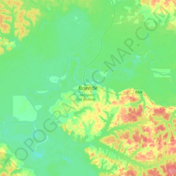
Name: Boende topographic map, elevation, terrain.
Location: Boende, Tshuapa, Democratic Republic of the Congo (-0.44366 20.72264 -0.12366 21.04264)
Average elevation: 1,122 ft
Minimum elevation: 1,053 ft
Maximum elevation: 1,306 ft
Thank you for supporting this site ❤️
Make a donation
Make a donation
Gear up for your next adventure:
As an Amazon Associate, this site earns from qualifying purchases at no extra cost to you.