
Thank you for supporting this site ❤️
Make a donation
Make a donation
Gear up for your next adventure:
As an Amazon Associate, this site earns from qualifying purchases at no extra cost to you.
Tellenmoos topographic map
Click on the map to display elevation.
Thank you for supporting this site ❤️
Make a donation
Make a donation
Gear up for your next adventure:
As an Amazon Associate, this site earns from qualifying purchases at no extra cost to you.
About this map
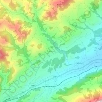
Name: Tellenmoos topographic map, elevation, terrain.
Location: Tellenmoos, Escholzmatt-Marbach, Lucerne, 6182, Suisse (46.91942 7.94620 46.95942 7.98620)
Average elevation: 3,002 ft
Minimum elevation: 2,438 ft
Maximum elevation: 4,104 ft
Thank you for supporting this site ❤️
Make a donation
Make a donation
Gear up for your next adventure:
As an Amazon Associate, this site earns from qualifying purchases at no extra cost to you.