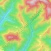
Udine topographic map
Click on the map to display elevation.
About this map

Name: Udine topographic map, elevation, terrain.
Location: Udine, Friuli – Venezia Giulia, 33100, Italy (46.00171 13.18448 46.11711 13.29448)
Average elevation: 344 ft
Minimum elevation: 217 ft
Maximum elevation: 656 ft
Other topographic maps
Click on a map to view its topography, its elevation and its terrain.


Tribil Superiore / Gorenji Tarbij
Italy > Friuli – Venezia Giulia > Udine > Stregna
Average elevation: 1,640 ft
Timau / Tischlbong
Italy > Friuli – Venezia Giulia > Udine > Paluzza / Paluce / Palutsch
Average elevation: 4,288 ft

Sauris di Sopra / Plozn / Sauris Disore
Italy > Friuli – Venezia Giulia > Udine
Average elevation: 4,820 ft