Geolocate

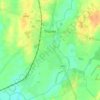
Lorrha topographic map

Click on the map to display elevation.

About this map

Name: Lorrha topographic map, elevation, terrain.

Location: Lorrha, The Municipal District of Nenagh, County Tipperary, Munster, E45 VF25, Ireland (53.07274 -8.14184 53.11274 -8.10184)

Average elevation: 167 ft

Minimum elevation: 102 ft

Maximum elevation: 305 ft

Other topographic maps

Click on a map to view its topography, its elevation and its terrain.

Islands

Ireland > County Tipperary

Average elevation: 322 ft

Thurles

Ireland > County Tipperary

Average elevation: 331 ft

Cloughjordan

Ireland > County Tipperary > Cloughjordan

Average elevation: 308 ft

Ballingarry

Ireland > County Tipperary

Average elevation: 259 ft

Southhill

Ireland > County Tipperary

Average elevation: 249 ft

Ballynamona

Ireland > County Tipperary

Average elevation: 197 ft

Youghal

Ireland > County Tipperary

Average elevation: 230 ft

Carrick-on-Suir

Ireland > County Tipperary

Average elevation: 135 ft

Hayes' Island

Ireland > County Tipperary

Average elevation: 125 ft

Barn Demense

Ireland > County Tipperary

Average elevation: 243 ft

Bishopswood

Ireland > County Tipperary

Average elevation: 354 ft

Ninemilehouse

Ireland > County Tipperary

Average elevation: 489 ft

Thomastown

Ireland > County Tipperary

Average elevation: 236 ft

Killough

Ireland > County Tipperary

Average elevation: 364 ft

Sopwell

Ireland > County Tipperary

Average elevation: 253 ft

Gear up for your next adventure:

🏔️Mountain Trail Maps - High‑detail maps for popular peaks
🧥Waterproof Jacket for Hiking - Breathable and rugged rain jacket for outdoor excursions
🎒Gear Packing Cubes - Organize your backpack efficiently
🔦Powerful Headlamps - Ultra-bright hands-free lighting for night navigation
🚁Photography Drones - Capture stunning aerial views of landforms and topography

As an Amazon Associate, this site earns from qualifying purchases at no extra cost to you.