
Thank you for supporting this site ❤️
Make a donation
Make a donation
Gear up for your next adventure:
As an Amazon Associate, this site earns from qualifying purchases at no extra cost to you.
Rennerod topographic map
Click on the map to display elevation.
Thank you for supporting this site ❤️
Make a donation
Make a donation
Gear up for your next adventure:
As an Amazon Associate, this site earns from qualifying purchases at no extra cost to you.
About this map
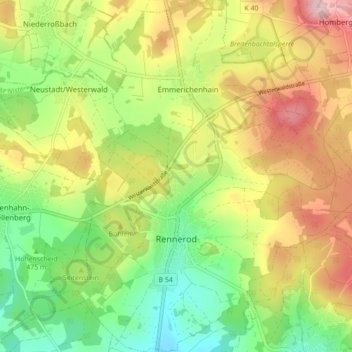
Name: Rennerod topographic map, elevation, terrain.
Location: Rennerod, Westerwaldkreis, Rijnland-Palts, 56477, Duitsland (50.58880 8.04175 50.64409 8.11498)
Average elevation: 1,663 ft
Minimum elevation: 1,332 ft
Maximum elevation: 2,073 ft
Thank you for supporting this site ❤️
Make a donation
Make a donation
Gear up for your next adventure:
As an Amazon Associate, this site earns from qualifying purchases at no extra cost to you.