Geolocate

Le Cupe topographic map

Click on the map to display elevation.

About this map

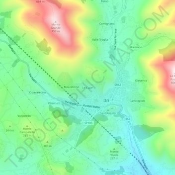
Name: Le Cupe topographic map, elevation, terrain.

Location: Le Cupe, Itri, Latina, Lazio, Italy (41.27403 13.50471 41.31403 13.54471)

Average elevation: 1,043 ft

Minimum elevation: 312 ft

Maximum elevation: 2,523 ft

Gear up for your next adventure:

🧯Emergency Survival Kit - All‑in‑one survival essentials for the backcountry
🚑Emergency Bivvies - Heat-reflective sleeping bags for survival situations
🎒Waterproof Dry Bags - Keep your electronics and maps dry inside your pack
🪶Camping Sleeping Pad - Comfortable sleeping pad for backpacking
🧦Merino Wool Socks - Moisture-wicking, blister-preventing socks for long treks

As an Amazon Associate, this site earns from qualifying purchases at no extra cost to you.