
Toraja Utara topographic map
Click on the map to display elevation.
About this map
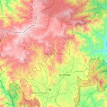
Name: Toraja Utara topographic map, elevation, terrain.
Location: Toraja Utara, South Sulawesi, Indonesia (-3.13579 119.67527 -2.58663 120.08653)
Average elevation: 4,393 ft
Minimum elevation: 259 ft
Maximum elevation: 9,334 ft
Other topographic maps
Click on a map to view its topography, its elevation and its terrain.