
Lewes topographic map
Click on the map to display elevation.
About this map
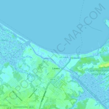
Name: Lewes topographic map, elevation, terrain.
Location: Lewes, Sussex County, Delaware, United States (38.75734 -75.19291 38.80719 -75.10323)
Average elevation: 7 ft
Minimum elevation: -13 ft
Maximum elevation: 46 ft
Sussex County trails, hiking, mountain biking, running and outdoor activities
Other topographic maps
Click on a map to view its topography, its elevation and its terrain.