
Thank you for supporting this site ❤️
Make a donation
Make a donation
Gear up for your next adventure:
As an Amazon Associate, this site earns from qualifying purchases at no extra cost to you.
Potrerillo topographic map
Click on the map to display elevation.
Thank you for supporting this site ❤️
Make a donation
Make a donation
Gear up for your next adventure:
As an Amazon Associate, this site earns from qualifying purchases at no extra cost to you.
About this map
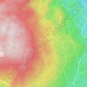
Name: Potrerillo topographic map, elevation, terrain.
Location: Potrerillo, Tezonapa, Veracruz, México (18.63389 -96.84861 18.67389 -96.80861)
Average elevation: 3,986 ft
Minimum elevation: 2,398 ft
Maximum elevation: 5,138 ft
Thank you for supporting this site ❤️
Make a donation
Make a donation
Gear up for your next adventure:
As an Amazon Associate, this site earns from qualifying purchases at no extra cost to you.