
Thank you for supporting this site ❤️
Make a donation
Make a donation
Gear up for your next adventure:
As an Amazon Associate, this site earns from qualifying purchases at no extra cost to you.
Roccadaspide topographic map
Click on the map to display elevation.
Thank you for supporting this site ❤️
Make a donation
Make a donation
Gear up for your next adventure:
As an Amazon Associate, this site earns from qualifying purchases at no extra cost to you.
About this map
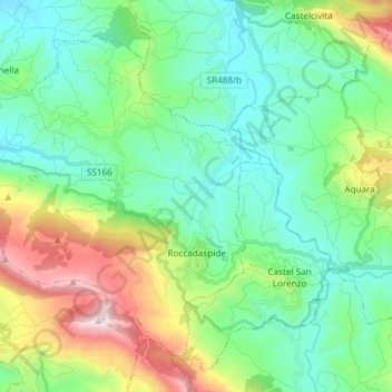
Name: Roccadaspide topographic map, elevation, terrain.
Location: Roccadaspide, Salerno, Campania, 84069, Italia (40.39547 15.06681 40.48828 15.21603)
Average elevation: 1,175 ft
Minimum elevation: 157 ft
Maximum elevation: 3,924 ft
Thank you for supporting this site ❤️
Make a donation
Make a donation
Gear up for your next adventure:
As an Amazon Associate, this site earns from qualifying purchases at no extra cost to you.