
Thank you for supporting this site ❤️
Make a donation
Make a donation
Gear up for your next adventure:
As an Amazon Associate, this site earns from qualifying purchases at no extra cost to you.
Fusaro topographic map
Click on the map to display elevation.
Thank you for supporting this site ❤️
Make a donation
Make a donation
Gear up for your next adventure:
As an Amazon Associate, this site earns from qualifying purchases at no extra cost to you.
About this map
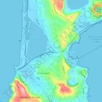
Name: Fusaro topographic map, elevation, terrain.
Location: Fusaro, Bacoli, Napoli, Campania, 80070, Italia (40.79907 14.04260 40.83907 14.08260)
Average elevation: 69 ft
Minimum elevation: -7 ft
Maximum elevation: 443 ft
Thank you for supporting this site ❤️
Make a donation
Make a donation
Gear up for your next adventure:
As an Amazon Associate, this site earns from qualifying purchases at no extra cost to you.