
Thank you for supporting this site ❤️
Make a donation
Make a donation
Gear up for your next adventure:
As an Amazon Associate, this site earns from qualifying purchases at no extra cost to you.
Humbolt topographic map
Click on the map to display elevation.
Thank you for supporting this site ❤️
Make a donation
Make a donation
Gear up for your next adventure:
As an Amazon Associate, this site earns from qualifying purchases at no extra cost to you.
About this map
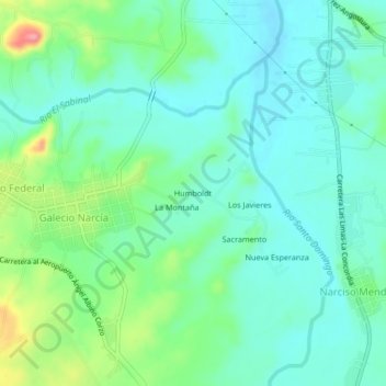
Name: Humbolt topographic map, elevation, terrain.
Location: Humbolt, Galecio Narcía, Chiapa de Corzo, Chiapas, Mexico (16.56985 -93.02792 16.60985 -92.98792)
Average elevation: 1,385 ft
Minimum elevation: 1,299 ft
Maximum elevation: 1,631 ft
Thank you for supporting this site ❤️
Make a donation
Make a donation
Gear up for your next adventure:
As an Amazon Associate, this site earns from qualifying purchases at no extra cost to you.