
Thank you for supporting this site ❤️
Make a donation
Make a donation
Gear up for your next adventure:
As an Amazon Associate, this site earns from qualifying purchases at no extra cost to you.
Açor topographic map
Click on the map to display elevation.
Thank you for supporting this site ❤️
Make a donation
Make a donation
Gear up for your next adventure:
As an Amazon Associate, this site earns from qualifying purchases at no extra cost to you.
About this map
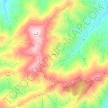
Name: Açor topographic map, elevation, terrain.
Location: Açor, Castelejo, Fundão, Castelo Branco, Portugal (40.07065 -7.66155 40.11065 -7.62155)
Average elevation: 2,487 ft
Minimum elevation: 1,654 ft
Maximum elevation: 3,294 ft
Thank you for supporting this site ❤️
Make a donation
Make a donation
Gear up for your next adventure:
As an Amazon Associate, this site earns from qualifying purchases at no extra cost to you.