
Make a donation
Gear up for your next adventure:
As an Amazon Associate, this site earns from qualifying purchases at no extra cost to you.
Montz topographic map
Click on the map to display elevation.
Make a donation
Gear up for your next adventure:
As an Amazon Associate, this site earns from qualifying purchases at no extra cost to you.
About this map
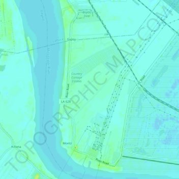
Name: Montz topographic map, elevation, terrain.
Location: Montz, St. Charles Parish, Louisiana, United States (29.99828 -90.47558 30.04169 -90.43509)
Average elevation: 10 ft
Minimum elevation: -7 ft
Maximum elevation: 49 ft
St. Charles Parish trails, hiking, mountain biking, running and outdoor activities
Make a donation
Gear up for your next adventure:
As an Amazon Associate, this site earns from qualifying purchases at no extra cost to you.
Other topographic maps
Click on a map to view its topography, its elevation and its terrain.
Mimosa Baseball and Tennis park
United States > Louisiana > St. Charles Parish > Luling > Mimosa Park
Average elevation: 10 ft