
Thank you for supporting this site ❤️
Make a donation
Make a donation
Gear up for your next adventure:
As an Amazon Associate, this site earns from qualifying purchases at no extra cost to you.
Paranda topographic map
Click on the map to display elevation.
Thank you for supporting this site ❤️
Make a donation
Make a donation
Gear up for your next adventure:
As an Amazon Associate, this site earns from qualifying purchases at no extra cost to you.
About this map
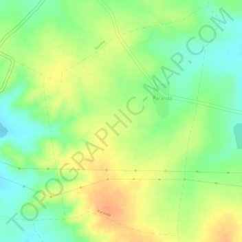
Name: Paranda topographic map, elevation, terrain.
Location: Paranda, Barshitakli, Akola District, Maharashtra, India (20.59724 77.11091 20.62284 77.13195)
Average elevation: 1,148 ft
Minimum elevation: 1,070 ft
Maximum elevation: 1,214 ft
Thank you for supporting this site ❤️
Make a donation
Make a donation
Gear up for your next adventure:
As an Amazon Associate, this site earns from qualifying purchases at no extra cost to you.