
Thank you for supporting this site ❤️
Make a donation
Make a donation
Gear up for your next adventure:
As an Amazon Associate, this site earns from qualifying purchases at no extra cost to you.
Atotonilco topographic map
Click on the map to display elevation.
Thank you for supporting this site ❤️
Make a donation
Make a donation
Gear up for your next adventure:
As an Amazon Associate, this site earns from qualifying purchases at no extra cost to you.
About this map
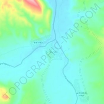
Name: Atotonilco topographic map, elevation, terrain.
Location: Atotonilco, Santiago Papasquiaro, Durango, Mexico (25.14528 -105.46582 25.18528 -105.42582)
Average elevation: 5,594 ft
Minimum elevation: 5,482 ft
Maximum elevation: 6,001 ft
Thank you for supporting this site ❤️
Make a donation
Make a donation
Gear up for your next adventure:
As an Amazon Associate, this site earns from qualifying purchases at no extra cost to you.