
Thank you for supporting this site ❤️
Make a donation
Make a donation
Gear up for your next adventure:
As an Amazon Associate, this site earns from qualifying purchases at no extra cost to you.
Tintange topographic map
Click on the map to display elevation.
Thank you for supporting this site ❤️
Make a donation
Make a donation
Gear up for your next adventure:
As an Amazon Associate, this site earns from qualifying purchases at no extra cost to you.
About this map
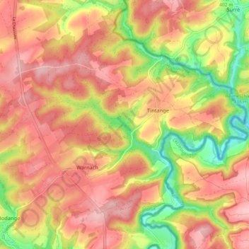
Name: Tintange topographic map, elevation, terrain.
Location: Tintange, Fauvillers, Bastogne, Luxembourg, Wallonie, Belgique (49.85237 5.69437 49.89822 5.78403)
Average elevation: 1,411 ft
Minimum elevation: 1,102 ft
Maximum elevation: 1,611 ft
Thank you for supporting this site ❤️
Make a donation
Make a donation
Gear up for your next adventure:
As an Amazon Associate, this site earns from qualifying purchases at no extra cost to you.