
Thank you for supporting this site ❤️
Make a donation
Make a donation
Gear up for your next adventure:
As an Amazon Associate, this site earns from qualifying purchases at no extra cost to you.
Canlubang topographic map
Click on the map to display elevation.
Thank you for supporting this site ❤️
Make a donation
Make a donation
Gear up for your next adventure:
As an Amazon Associate, this site earns from qualifying purchases at no extra cost to you.
About this map
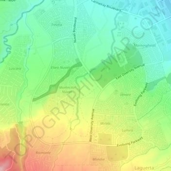
Name: Canlubang topographic map, elevation, terrain.
Location: Canlubang, Calamba, Laguna, Calabarzon, 4028, Philippines (14.17196 121.05110 14.21196 121.09110)
Average elevation: 525 ft
Minimum elevation: 302 ft
Maximum elevation: 873 ft
Thank you for supporting this site ❤️
Make a donation
Make a donation
Gear up for your next adventure:
As an Amazon Associate, this site earns from qualifying purchases at no extra cost to you.