Geolocate

Pasir Raja topographic map

Click on the map to display elevation.

About this map

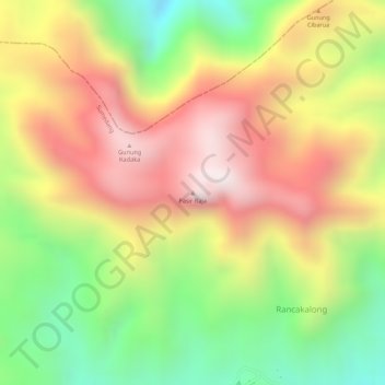
Name: Pasir Raja topographic map, elevation, terrain.

Location: Pasir Raja, Sumedang, West Java, Java, Indonesia (-6.81427 107.80696 -6.81417 107.80706)

Average elevation: 4,446 ft

Minimum elevation: 3,258 ft

Maximum elevation: 5,420 ft

Gear up for your next adventure:

🪶Survival Guide Book - Expert advice for emergency preparedness
📦Gear Storage Bags - Organize and protect outdoor equipment
🎒Gear Packing Cubes - Organize your backpack efficiently
🪶Fire Starter Kit - Reliable fire starter for survival and camping
🛶Inflatable Kayak - Portable kayak for rivers, lakes, and expeditions

As an Amazon Associate, this site earns from qualifying purchases at no extra cost to you.