
Thank you for supporting this site ❤️
Make a donation
Make a donation
Gear up for your next adventure:
As an Amazon Associate, this site earns from qualifying purchases at no extra cost to you.
Lidong topographic map
Click on the map to display elevation.
Thank you for supporting this site ❤️
Make a donation
Make a donation
Gear up for your next adventure:
As an Amazon Associate, this site earns from qualifying purchases at no extra cost to you.
About this map
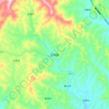
Name: Lidong topographic map, elevation, terrain.
Location: Lidong, Yunan County, Yunfu City, Guangdong Province, China (22.93624 111.61961 23.01624 111.69961)
Average elevation: 909 ft
Minimum elevation: 213 ft
Maximum elevation: 2,320 ft
Thank you for supporting this site ❤️
Make a donation
Make a donation
Gear up for your next adventure:
As an Amazon Associate, this site earns from qualifying purchases at no extra cost to you.