
Thank you for supporting this site ❤️
Make a donation
Make a donation
Gear up for your next adventure:
As an Amazon Associate, this site earns from qualifying purchases at no extra cost to you.
Esojipet topographic map
Click on the map to display elevation.
Thank you for supporting this site ❤️
Make a donation
Make a donation
Gear up for your next adventure:
As an Amazon Associate, this site earns from qualifying purchases at no extra cost to you.
About this map
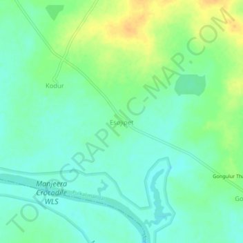
Name: Esojipet topographic map, elevation, terrain.
Location: Esojipet, Pulkal mandal, Sangareddy, Telangana, 502293, India (17.68281 78.01212 17.72281 78.05212)
Average elevation: 1,680 ft
Minimum elevation: 1,644 ft
Maximum elevation: 1,739 ft
Thank you for supporting this site ❤️
Make a donation
Make a donation
Gear up for your next adventure:
As an Amazon Associate, this site earns from qualifying purchases at no extra cost to you.