
Edgewood topographic map
Click on the map to display elevation.
About this map
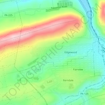
Name: Edgewood topographic map, elevation, terrain.
Location: Edgewood, Northumberland County, Pennsylvania, United States (40.78352 -76.59134 40.79314 -76.56427)
Average elevation: 974 ft
Minimum elevation: 669 ft
Maximum elevation: 1,457 ft
Northumberland County trails, hiking, mountain biking, running and outdoor activities