
Northwoods topographic map
Click on the map to display elevation.
About this map
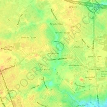
Name: Northwoods topographic map, elevation, terrain.
Location: Northwoods, Henrico County, Virginia, 23228, United States (37.62070 -77.49887 37.66070 -77.45887)
Average elevation: 197 ft
Minimum elevation: 125 ft
Maximum elevation: 233 ft
Henrico County trails, hiking, mountain biking, running and outdoor activities
Other topographic maps
Click on a map to view its topography, its elevation and its terrain.
Canterbury Lake
United States > Virginia > Henrico County > Tuckahoe > Canterbury
Average elevation: 190 ft
Canterbury Dam
United States > Virginia > Henrico County > Tuckahoe > Canterbury
Average elevation: 187 ft