Geolocate

Sitharevu topographic map

Click on the map to display elevation.

About this map

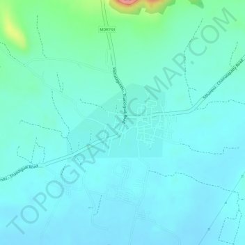
Name: Sitharevu topographic map, elevation, terrain.

Location: Sitharevu, Athoor, Dindigul District, Tamil Nadu, 624204, India (10.23865 77.77455 10.24743 77.78565)

Average elevation: 935 ft

Minimum elevation: 863 ft

Maximum elevation: 1,273 ft

Other topographic maps

Click on a map to view its topography, its elevation and its terrain.

Chinnalapatti

India > Tamil Nadu > Athoor

Average elevation: 1,066 ft

Attur

India > Tamil Nadu > Athoor

Average elevation: 981 ft

Attur

India > Tamil Nadu > Athoor

Average elevation: 981 ft

Gear up for your next adventure:

🔥Camping Stove - Portable stove for camping and backcountry cooking
🌎3D Topographic Globes - Raised relief globes for a tactile understanding of geography
🧥Waterproof Jacket for Hiking - Breathable and rugged rain jacket for outdoor excursions
🎒Trail Energy Bars - High‑calorie bars for hiking energy
🧦Merino Wool Socks - Moisture-wicking, blister-preventing socks for long treks

As an Amazon Associate, this site earns from qualifying purchases at no extra cost to you.