
Silver Springs State Park topographic map
Interactive map
Click on the map to display elevation.
About this map
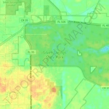
Name: Silver Springs State Park topographic map, elevation, terrain.
Average elevation: 69 ft
Minimum elevation: 20 ft
Maximum elevation: 121 ft
Other topographic maps
Click on a map to view its topography, its elevation and its terrain.
Ocala
United States > Florida > Marion County
Ocala, Marion County, Florida, United States
Average elevation: 92 ft
Dunnellon
United States > Florida > Marion County
Dunnellon, Marion County, Florida, 35431, United States
Average elevation: 69 ft
Ocala National Forest
United States > Florida > Marion County
Ocala National Forest, Marion County, Florida, United States
Average elevation: 66 ft
Marion Oaks
United States > Florida > Marion County
Marion Oaks, Marion County, Florida, 34473, United States
Average elevation: 92 ft
Forest Lakes Park
United States > Florida > Marion County
Forest Lakes Park, Marion County, Florida, 32183, United States
Average elevation: 72 ft
Silver Springs Shores
United States > Florida > Marion County
Silver Springs Shores, Marion County, Florida, United States
Average elevation: 75 ft
Orange Blossom Hills
United States > Florida > Marion County
Orange Blossom Hills, Marion County, Florida, 34491, United States
Average elevation: 92 ft
Orange Lake
United States > Florida > Marion County
Orange Lake, Marion County, Florida, 32681, United States
Average elevation: 105 ft
Fort McCoy
United States > Florida > Marion County
Fort McCoy, Marion County, Florida, 34489, United States
Average elevation: 66 ft
Ocala
United States > Florida > Marion County > Ocala
Ocala, Marion County, Florida, 34471:34474, United States
Average elevation: 89 ft
East Silver Springs Shore
United States > Florida > Marion County
East Silver Springs Shore, Marion County, Florida, 32183, United States
Average elevation: 79 ft
Citra
United States > Florida > Marion County
Citra, Marion County, Florida, 32113, United States
Average elevation: 79 ft
Orange Springs
United States > Florida > Marion County
Orange Springs, Marion County, Florida, 32182, United States
Average elevation: 69 ft
Weirsdale
United States > Florida > Marion County
Weirsdale, Marion County, Florida, 32195, United States
Average elevation: 102 ft
Reddick
United States > Florida > Marion County
Reddick, Marion County, Florida, United States
Average elevation: 108 ft
Belleview
United States > Florida > Marion County
Belleview, Marion County, Florida, United States
Average elevation: 95 ft
Lake Bryant
United States > Florida > Marion County
Lake Bryant, Marion County, Florida, United States
Average elevation: 59 ft
Ocklawaha
United States > Florida > Marion County
Ocklawaha, Marion County, Florida, 34483, United States
Average elevation: 72 ft
Rainbow Springs State Park
United States > Florida > Marion County > Rainbow Falls
Rainbow Springs State Park, Rainbow Falls, Marion County, Florida, United States
Average elevation: 69 ft
Ocala Ridge
United States > Florida > Marion County > Ocala Ridge
Ocala Ridge, Marion County, Florida, 34474, United States
Average elevation: 89 ft
Juniper Springs
United States > Florida > Marion County
Juniper Springs, Florida Trail, Marion County, Florida, United States
Average elevation: 56 ft
Summerfield
United States > Florida > Marion County
Summerfield, Marion County, Florida, 34492, United States
Average elevation: 95 ft
Salt Springs
United States > Florida > Marion County
Salt Springs, Marion County, Florida, United States
Average elevation: 30 ft