
Thank you for supporting this site ❤️
Make a donation
Make a donation
Gear up for your next adventure:
As an Amazon Associate, this site earns from qualifying purchases at no extra cost to you.
Acahuizotla topographic map
Click on the map to display elevation.
Thank you for supporting this site ❤️
Make a donation
Make a donation
Gear up for your next adventure:
As an Amazon Associate, this site earns from qualifying purchases at no extra cost to you.
About this map
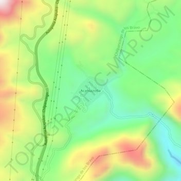
Name: Acahuizotla topographic map, elevation, terrain.
Location: Acahuizotla, Chilpancingo de los Bravo, Guerrero, México (17.34056 -99.48778 17.38056 -99.44778)
Average elevation: 3,261 ft
Minimum elevation: 2,096 ft
Maximum elevation: 5,020 ft
Thank you for supporting this site ❤️
Make a donation
Make a donation
Gear up for your next adventure:
As an Amazon Associate, this site earns from qualifying purchases at no extra cost to you.