Geolocate

Bowscale topographic map

Click on the map to display elevation.

About this map

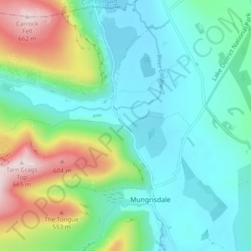
Name: Bowscale topographic map, elevation, terrain.

Location: Bowscale, Mungrisdale, Westmorland and Furness, England, CA11 0XH, United Kingdom (54.65609 -3.01564 54.69609 -2.97564)

Average elevation: 1,076 ft

Minimum elevation: 692 ft

Maximum elevation: 2,172 ft

Other topographic maps

Click on a map to view its topography, its elevation and its terrain.

Gear up for your next adventure:

👟Trail Running Shoes - Lightweight shoes for trail runners
📶Vehicle Signal Boosters - Improve reception in rural areas while driving to trailheads
🧼Biodegradable Camping Soap - Eco‑friendly soap for outdoor hygiene
🪑Portable Camp Table - Compact table for campsite meals
🛰️Satellite Messengers - Emergency SOS and two-way messaging for off-grid adventures

As an Amazon Associate, this site earns from qualifying purchases at no extra cost to you.