
Thank you for supporting this site ❤️
Make a donation
Make a donation
Gear up for your next adventure:
As an Amazon Associate, this site earns from qualifying purchases at no extra cost to you.
Huntington topographic map
Click on the map to display elevation.
Thank you for supporting this site ❤️
Make a donation
Make a donation
Gear up for your next adventure:
As an Amazon Associate, this site earns from qualifying purchases at no extra cost to you.
About this map
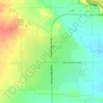
Name: Huntington topographic map, elevation, terrain.
Location: Huntington, Emery County, Utah, 84528, United States (39.31564 -110.97881 39.34319 -110.94582)
Average elevation: 5,797 ft
Minimum elevation: 5,722 ft
Maximum elevation: 5,906 ft
Emery County trails, hiking, mountain biking, running and outdoor activities
Thank you for supporting this site ❤️
Make a donation
Make a donation
Gear up for your next adventure:
As an Amazon Associate, this site earns from qualifying purchases at no extra cost to you.